01 · Start
Start and orient
The map gives spatial context to the source-linked rescue log. It does not provide underground navigation.
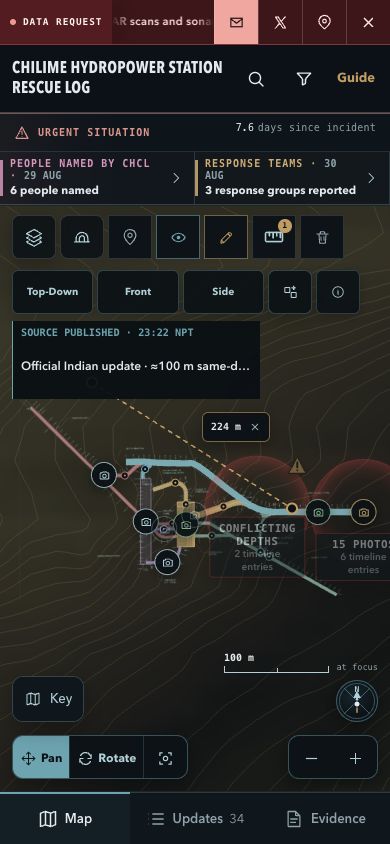
Tools are above the map; Map, Updates, and Evidence are below it.
- Top tools
- Layers, Reconstruction, Photos, Markers, Annotate, Measure
- View row
- Top-Down, Front, Side, Projection, Map limits
- Bottom
- Map, Updates, Evidence
Before field use In Layers, select the post-flood DSM and choose Save 500 m terrain offline. Confirm it completes. Original sources and on-demand OSM or satellite imagery still need connectivity.
02 · Navigate
Move and change view
Choose the movement mode first, then inspect the same feature from more than one direction.
- Pan or Rotate: choose one, then drag with one finger.
- Zoom: pinch or use + and −.
- Reset: restores framing but keeps layers, notes, filters, and measurements.
- Views: use Top-Down for plan, Front or Side for profile, and Current for 3D context.
North The compass uses an assumed plan bearing. It is approximate—not verified drawing-up or survey north.
03 · Context
Layers and routes
Use Layers for terrain context and Reconstruction to isolate a named route or chamber.
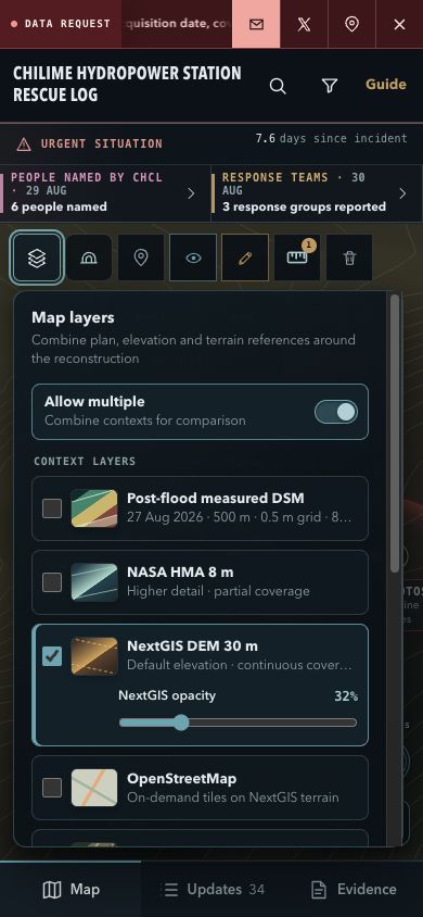
Compare sources; do not treat either terrain model as a current site survey.
- Post-flood DSM
- Measured-only 27 Aug surface inside 500 m; 83.4% coverage and NoData at the station reference. A 0.5 m grid is not an accuracy claim.
- Historical terrain
- NextGIS 30 m is continuous broad context; NASA HMA 8 m has partial/no-data coverage. Neither fills measured voids automatically.
- OSM / satellite
- Network-loaded surface context; satellite is draped over terrain.
- Chainage drawing
- Vector source drawing with unresolved datum, bearing, gradients, and endpoints.
Route check Select a route in Reconstruction, inspect it in Top-Down and Side, then compare its chainage against the source drawing.
04 · Core tool
Measure
The ruler draws a provisional straight line on the active orthographic view plane.
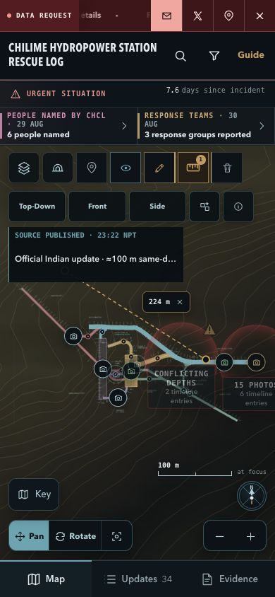
Measurements save automatically in this browser.
- Select Top-Down, Front, or Side.
- Tap Measure, then press-drag-release.
- Drag either endpoint to refine it. Use × to remove one or trash to clear the view.
Coordinates and EL WGS84 is approximate. Model EL uses drawing EL 1387.492 m with an unverified EGM2008 tie. Decimal places do not establish accuracy.
05 · Record
Photos and notes
Keep source evidence separate from your personal browser-local observations.
Photos
- Enable Photos or Markers and open a marker.
- Read whether it is exact, approximate, historical, or area only.
- Open the linked update and original source before relying on it.
Personal notes
- Tap Annotate, then visible route or surface geometry.
- Write up to 280 characters and tap Place note.
- Reopen the marker to edit or delete it.
Do not store sensitive data
Up to 50 notes stay only in the current browser. They are not synced, backed up, encrypted, exported, or shared.
06 · Verify
Updates and evidence
Read time basis, verification, known facts, and unknowns before carrying a claim into field notes.
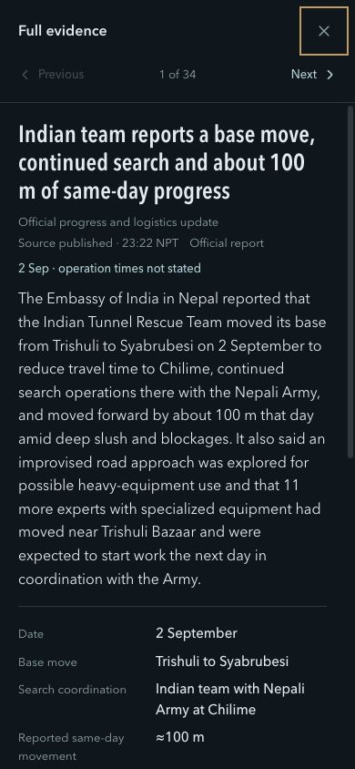
Full evidence keeps the source, limits, and revisions together.
- Open Updates and select a report.
- Check whether its date means Published, Source date, or Occurred. Times use NPT (UTC+05:45).
- Read the verification label and unknowns.
- Open Full evidence, then the original source.
- Record app-derived values with their view, layer, source, and uncertainty.
Quick troubleshooting
- Cannot measure
- Select Top-Down, Front, or Side and confirm Orthographic projection.
- No coordinate
- Return to Top-Down and tap visible geometry. If it still fails, treat it as unavailable.
- Local data disappeared
- Notes and measurements do not follow you to another browser, profile, or device.