Understand the workspace
The desktop layout keeps the report timeline beside the spatial reconstruction. Report details open while the map remains visible.
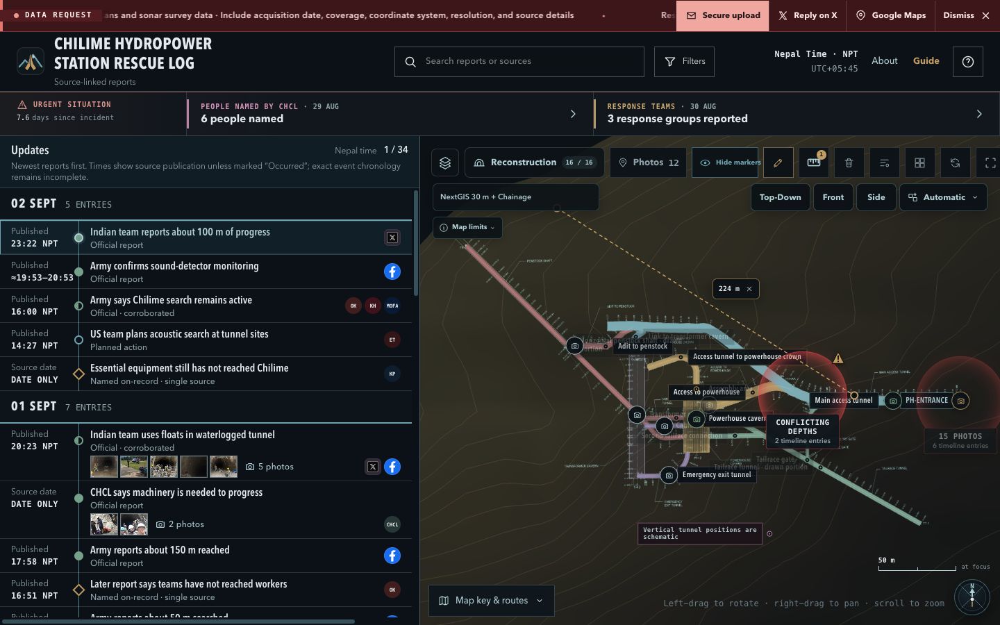
- Timeline
- Newest-first, source-linked updates. Search and Filters reduce the list.
- Map
- Terrain, source drawings, reconstructed routes, markers, and personal notes.
- Report detail
- Open the selected report for its summary, dates, sources, unknowns, and revisions.
Read reports before the map
- 1
Find the report. Search text or filter by source, verification, media, and date.
- 2
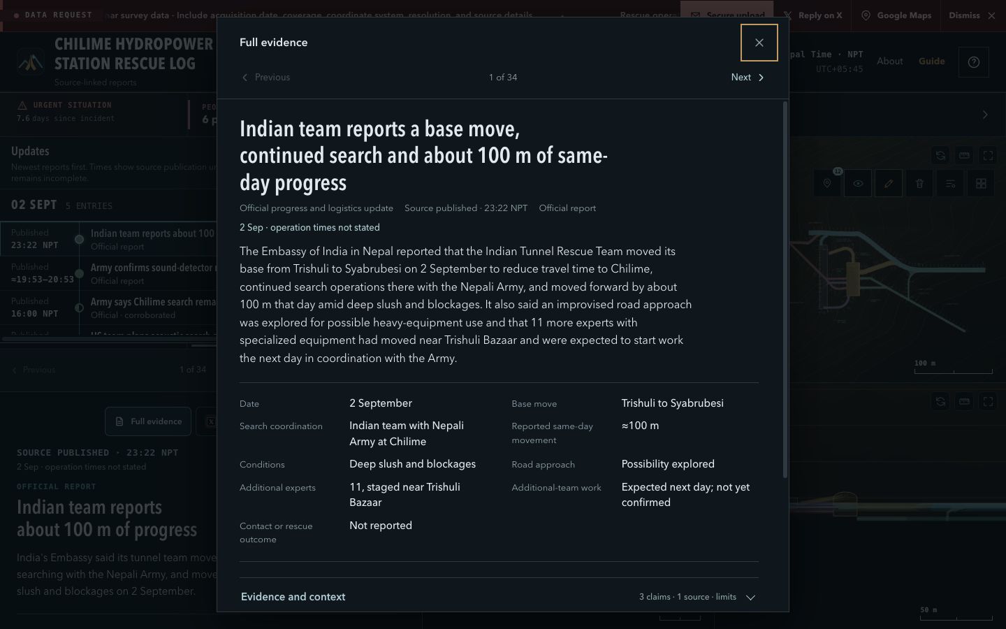
Select it. The evidence panel updates; selecting a report does not assign it to a tunnel location.
- 3
Check time basis. Published, Source date, and Occurred mean different things. All displayed times use NPT (UTC+05:45).
- 4
Open Full evidence. Review claims, unknowns, revisions, and the original source.
Control the map
Rotate around the current focus.
Pan without changing view angle.
Zoom toward the pointer.
Pan the focused viewport.
Zoom the focused viewport.
Restore framing; layers, notes, filters, and measurements remain.
Choose a view deliberately: Top-Down for plan relationships, Front or Side for relative elevation, and Current for free 3D inspection. Use Orthographic for measurement.
Use four synchronized views
Select the four-square control to compare Current, Top, Front, and Side without repeatedly changing the main camera.
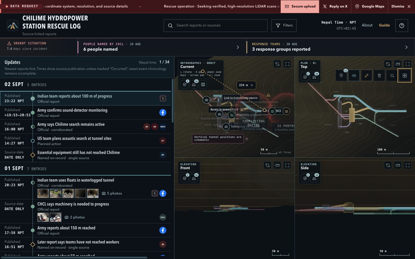
- Click a viewport before using keyboard pan or zoom.
- Current supports orbit navigation; fixed views preserve their axes.
- Use the maximize control to inspect one view, then return to the grid.
Make a provisional measurement
- 1
Select Top-Down, Front, Side, or an orthographic Current view.
- 2
Choose the ruler for that view, then press-drag-release between visible points.
- 3
Drag endpoints to refine. Measurements save locally and separately for Current, Top, Front, and Side.
Position readouts: WGS84 is approximate. Model EL uses drawing EL 1387.492 m with an unverified EGM2008 tie. Decimal precision is not survey accuracy.
Control layers, markers, and notes
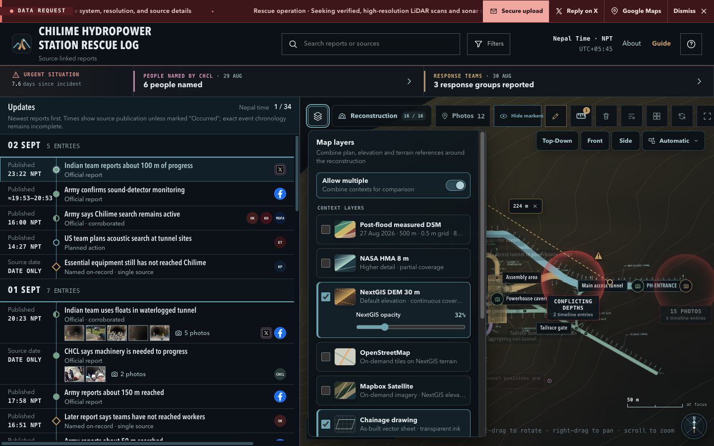
Terrain
The measured-only 27 Aug DSM covers 83.4% inside 500 m and is NoData at the station point; 0.5 m is grid spacing, not accuracy. NextGIS and NASA remain historical alternatives.
Photos and markers
Read whether a location is exact, approximate, historical, or area only. Open its source before relying on it.
Personal notes
Annotate visible geometry with up to 280 characters. Notes stay in this browser only; do not enter sensitive data.
Offline: Select the post-flood DSM in Layers, then choose Save 500 m terrain offline. This stores measured terrain and core map files on the device; original sources and on-demand basemaps still require connectivity.
Close with verification
EvidenceWhich source supports the claim?
ViewWhich projection and direction did you use?
LayerWhich terrain or drawing was visible?
ResultIs the value app-derived and provisional?
ControlWhat authorised survey record verifies it?
Quick troubleshooting
- Four-view is unavailable
- Wait for the reconstruction to finish loading; the control enables when the map is ready.
- Measurement will not start
- Use an orthographic preset and activate the ruler for the intended viewport.
- Coordinate is missing
- Return to Top-Down and select visible geometry. If it remains absent, treat it as unavailable.
- Local work disappeared
- Notes and measurements do not follow you to another browser, profile, or device.